

From Uspantan to Coban...
From Chichi, our destination was to reach Flores and the Tikal ruins. But as the distance was too long we decided to have a break in Coban.
From Chichi, we took a "collectivo" (or van for around 15 persons) to the capital of the region Santa Cruz Del Quiche. Nothing to report. From here, we took another "collectivo" to Uspantan. Here also nothing to report. Arriving to Uspantan at about 11am, we learned that the collectivo for Coban has already left and the next one was at 4.30pm! Obviously we were not very happy and locals more than us! Finally a collectivo from an another company arrived and departure to Coban at 2.30pm. And the 2 hours we spent to reach Coban were the most amazing from all our trip (and we saw many countries!!!). After 30min on normal road, the road was only a dirt road, then approaching to the village of San Cristobal Verapaz, we passed a very delicate zona where a full side of the mountain was missing due to a landslide. Amazing!!! Just amazing but how dangerous!!!
What has happened? I found the story in the newspaper 1 month later. In January 2009, the side of the mountain collapsed taking the lives of 22 people. The government had placed signs to not use the road crossing the mountain due to the instability of the soil due to a seismic rift. But locals were still using the road ...when the accident occurred. Then in March, due to the lack of action from the government (which is thinking that the area is of too much danger), locals created the road we took and volunteers, situated to the control gate (open between 6am-6pm) filter the cars to prevent 2 cars passing at the same time as the road was not very stable and collect a toll to start the building of a proper road. There is an alternative road (not without dangers too) but as a deviation, instead of 10min, 2 hours are necessary to pass the mountain. So locals, like the collectivo we took, are using the temporary road.
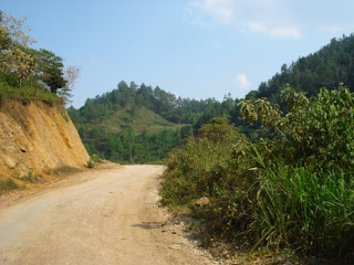
- The beginning of the dirt road. Lee, me and a young boy were situated in the passenger seat (stuck like sardines!!!) and I was literally stuck to the door with the window fully open (very hot) and I was on a first place to see in detail the road and the surroundings. Nice position too to get some nice pictures!
- First sign: "Danger, zona of precipices, there is no way to go." Hum...what is that?
- Second sign: "You are going along your own risk. Municipality of San Cristobal Verapaz". Hum...where are we going?
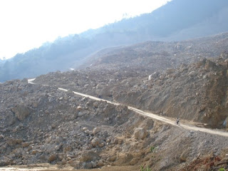
- Then after passing a control gate, we approached to the danger zona and we saw this full side of the mountain missing,
- This is the road we took during 10min,
- A panoramic view of the road (bottom left) and the missing side of the mountain. The picture was taking from a higher point as after going down to pass the mountain we went slowly up again.


No comments:
Post a Comment